
This project has received funding from the European Union’s Horizon 2020 research and innovation programme under grant agreement No 952327.

This project has received funding from the European Union’s Horizon 2020 research and innovation programme under grant agreement No 952327.

The Geography Department belongs to the Humboldt University of Berlin Faculty of Mathematics and Natural Science. It is an integral part of the “Science and Technology Park Berlin-Adlershof”. Hosting nine labs, the department covers the whole thematic range of geography, from applied geography and urban planning, to cultural, social and economic geography, from geomatics to spatial modelling, and from the geography of soils to biogeography and landscape ecology. Research groups study the interactions and feedbacks between people and their natural and built-up surroundings. This involves studying the multiple, shifting geographies of coupled human-environment systems and how they contribute to processes of global change, notably climate change, land-use change, globalization, urbanization and biosphere change. Fundamental to the research is the recognition that flows of materials, energy, people, information, ideas and capital are increasingly transgressing traditional notions of the global and local, the urban and rural, and the human and natural. Bringing together the various sub-disciplines represented in the department the main research question is being answered "How can geography enable a better understanding of contemporary human-environment?" Two thematic research groups address this question: The Land Systems Research Group and The Urban Research Group.
The Land Systems Research Group role is to identify the key drivers, geographical patterns and impacts of land change – including feedback mechanisms, and multidirectional flows of energy or matter over distance. To tackle these issues the Land Systems Research Group combines concepts and methodologies of place-based land research, such as field experiments, remote sensing and geoinformation science, geospatial statistics and analyses, and process-based spatial modelling, as well as approaches focusing on linkages and networks of interaction, such as global value chain analyses, network analyses, assessments of environmental justice, sustainability and sociocultural understandings of globalization, and the telecouplings concept.
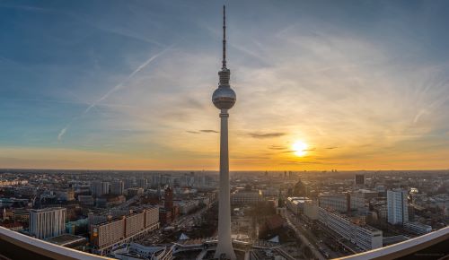
The Urban Research Group believes that engaging with ‘the urban age’ starts with the development of theoretical concepts, research questions and mixed methodologies capable of capturing the complexity of urban systems. The group explores this complexity by way of a combination of methods, spanning the qualitative (e.g., interviews, surveys, participant observation) and quantitative (e.g., field measurements, remote sensing, GIS, geospatial modelling, statistics). Geographically, the group focusses primarily on Berlin, an illuminating urban-regional context with a long research tradition at the Geography Department, studying topics such as environmental justice, healthy living environments, urban ecosystem services (including soils and urban micro-climates), gentrification, urban agriculture, urban infrastructures and urban
The Geography Department regularly lead and participates in a broad range of EC FP7 and Horizon 2020, Interreg, Marie Curie, ERC and eContentPlus activities. Three research groups, the Lab of Landscape Ecology, Conservation Biogeography Lab and Geomatics and Geoinformation Science Labs are chiefly involved in this proposal. The Lab of Landscape Ecology at the Institute of Geography deals with ecosystems, ecosystem services, land use and its actors along the urban to rural gradient. The main topics are land use change, human and urban footprint, ecosystem services, multicriteria risk, resilience and system analysis. The Conservation Biogeography Lab assesses land system change, particularly in regards to pattern and drivers of land-use change, and how land system change impacts biodiversity. A third focal point is research on what characterizes effective conservation and sustainable land systems. The group develops and applies approaches grounded in spatial ecology, geography, social science, conservation planning, spatial statistics, econometric modelling, and remote sensing. The group works heavily interdisciplinary and strongly collaboratively with researchers and science institutions worldwide, and is an active contributor to a range of international science networks such as Future Earth’s Global Land Programme.
The Geomatics and Geoinformation Science Labs focus on developing and applying remote sensing methods to better understand global change related to land systems. They map land cover and land use and related spatio-temporal change patterns. Applications extend from agriculture (both cropland and grassland), over forest ecosystems to urban areas. The analysis of long and dense time series from Landsat and Sentinel data is core for the research - from landscape to continental scales. Hyperspectral image analysis is a second cornerstone of the Geomatics Lab. To study the human environment system they focus on the development and application of different state-of-the-art techniques of spatio-temporal modelling in land system science including cellular automata, Bayesian Belief networks, agent-based modelling, machine learning and advanced regression analysis.
PROJECT TEAM:
Dagmar Haase
Tobias Kuemmerle
Tobia Lakes
André Mascarenhas
Kathrin Trommler